Mirror of the sky

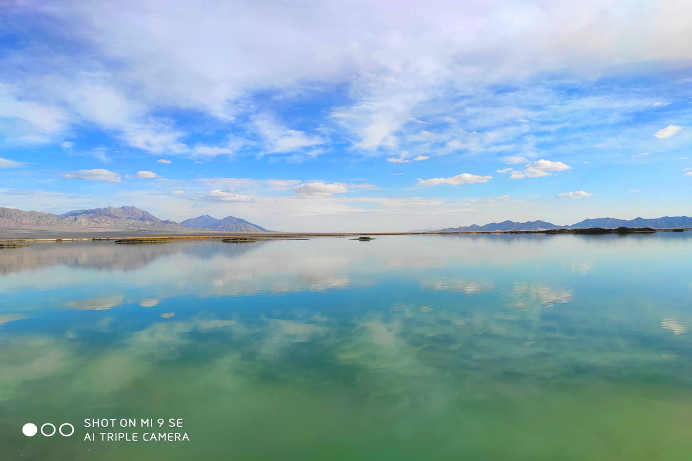
When I first came to Chaka Salt Lake and saw the scene of the salt lake, I was shocked. You can’t imagine such clear and bright lake water in the plateau area with an altitude of 3000 meters. Like a mirror, the calm lake reflects the beautiful and suffocating sky scenery, reflecting the surrounding snow mountain scene on the lake, known as the “mirror of China’s sky”. In the world of salt, walking on the lake is like walking on the cloud top, as if flying in a dream paradise.
Chaka Salt Lake is located in Chaka Town, Wulan County, Haixi Prefecture, Qinghai Province. Chaka is a Tibetan language, which means Salt Lake, the sea of green salt. This is an important site of the ancient Silk Road, known as the east gate of Qaidam Basin.
Chaka Salt Lake is an inland lake. Due to plate movement, the junction of Eurasian plate and Indian Ocean plate covered by sea water gradually rises to Qinghai Tibet Plateau. During the formation of the Qinghai Tibet Plateau, part of the sea water accumulated in the low-lying areas, forming many salt lakes and ponds, of which Chaka Salt Lake is one.
Chaka Salt Lake before and after sunrise and sunset is the most beautiful period of salt lake scenery. Colorful clouds, sunrise or sunset reflect the salt lake, forming a picture of water and sky.
当我第一次来到茶卡盐湖,见到盐湖的景象时,我被震惊了。你不会想象到在海拔3000米的高原地带,会有如此清澈明亮的湖水,平静的湖面像镜子一样,反射着美丽的令人窒息的天空景色,将四周环绕的雪山景象倒影在湖面上,被誉为“中国天空之镜”,置身于盐的世界,漫步湖面如行走云端之上,仿佛翱翔梦中天堂。
茶卡盐湖位于青海省海西州乌兰县茶卡镇,茶卡是藏语,意即盐池,也就是青盐的海。这里是古丝绸之路的重要站点,被誉为柴达木盆地东大门。
茶卡盐湖为内陆湖泊,由于板块运动,原被海水所覆盖的亚欧板块与印度洋板块的交界地带逐渐隆起为青藏高原。在青藏高原的形成过程中,部分海水积留在低洼地带,形成了许多盐湖和池塘,茶卡盐湖就是其中之一。
日出日落前后的茶卡盐湖为盐湖风光最美的时段,彩云、朝阳或夕阳照映盐湖,形成水天一色的画面。


Comments